 PYO Mapsby Pomona Systems
Green Mountain Orchards · Putney, Vermont
Drawn from your real blocks and rows. Opens from a QR code on a sign. Shows what's ripe today, and walks them to it.
Saturday,
10:40 a.m.
Somebody at your stand answers these four hundred times a weekend, from memory, and the answer changes every ten days. Put it on a sign instead.
Legend
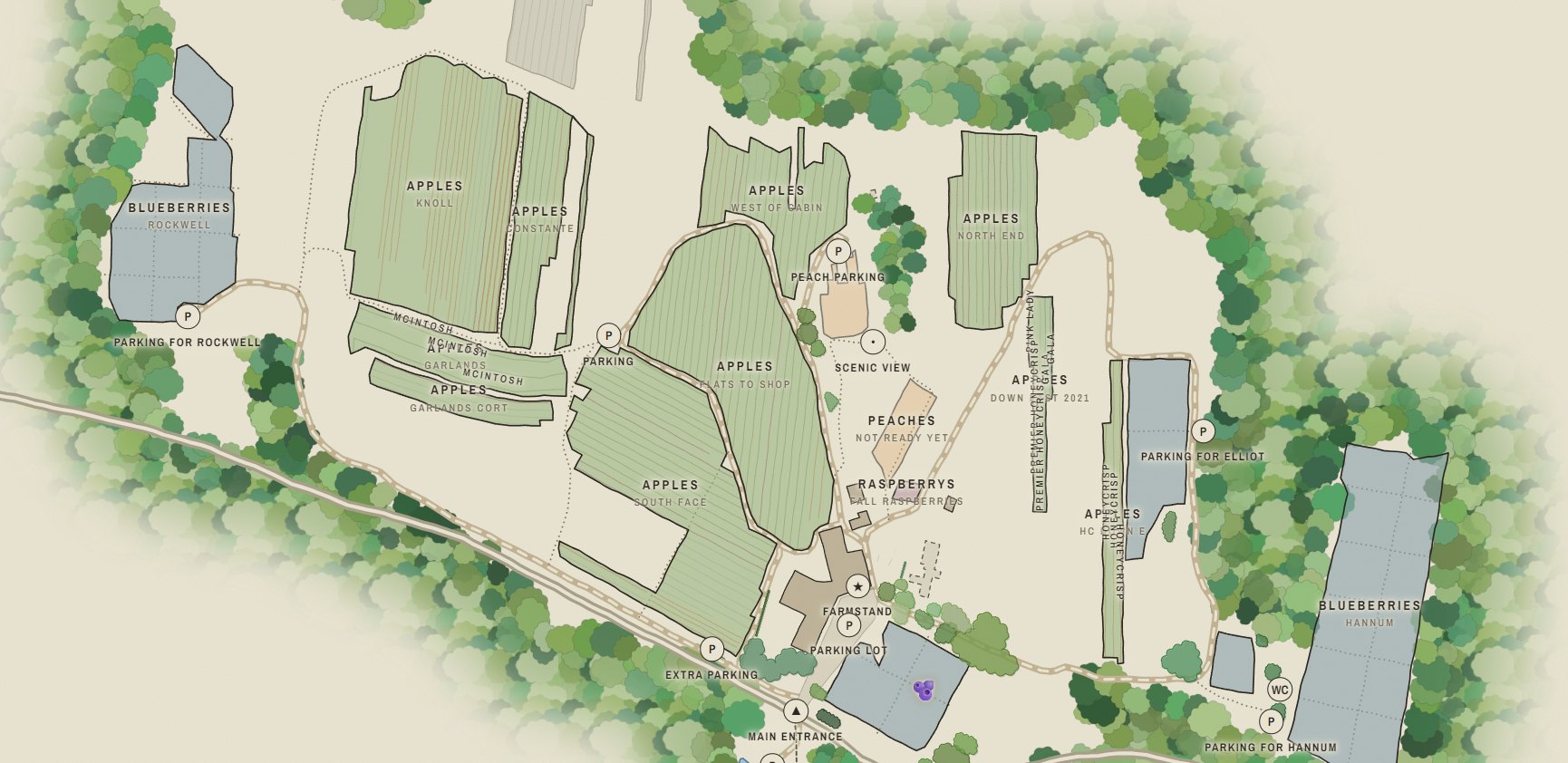
Everything is drawn to real coordinates. It isn't a picture of your farm — it's your farm, at scale, on a phone.
Every block outline and every row line comes from a record of where the planting actually is, at its real spacing and orientation — so what a customer sees on the phone matches what is in front of them. The little trees are a drawing convention. What sits underneath them is measured ground, not a sketch.
The visitor's own phone GPS, on your farm's map, in the browser. Nothing to download and no account to make. They scan the code on the sign and the dot is already there.
Along your lanes and footpaths, to the end of a row — never a straight line through the trees. Distances are honest: feet up to about a quarter mile, then miles.
You get a grower's page on your phone — your Pomona login, nothing to install. Set a variety to picking, not ready, or finished and every visitor's map changes within seconds. Close a block for the day when it's been sprayed or picked out. Drop a pin on a good patch, choose how long it should stand, and it clears itself when that runs out rather than quietly going stale. The map also shows visitors when you last touched it, so it never pretends to be more current than it is.
Posters sized for the stand, the parking lot and the barn door. The address stays the same year to year, so last season's signs keep working.
pyomaps.com/greenmountain
Green Mountain Orchards in Putney, Vermont — apples, blueberries and peaches. Every block, row, lane, pond and stone wall on that map is where it actually is.
Try it on your phone: tap a variety, then tap Directions. Give it your location and it will route you from wherever you're sitting — which, if you're not in Putney, it will politely tell you.
Getting one
made
A first map takes about a week from the day we have your answers.
Everything on the map sits at its true position on the ground, to within a few feet — which means somebody has to have recorded where each block and each row actually is. If you keep records in Pomona, that already exists and comes across untouched. If you don't, we trace it during setup — that works, it costs more, and a traced row is a good guess where a recorded one is a fact.
Lanes, footpaths, parking, the barn, the pond, the hedgerow, the big maple everyone says to meet at. Nobody but you knows any of that, so we get it out of you once — a call with a satellite photo up on both screens, a marked-up printout, or a walk round with your phone. Drawing it is the slow part, and that part is ours. Yours is about an hour.
We send print-ready posters with the code on them. After that the only thing you touch all season is what's ripe — from your phone, in the truck, between customers.
Answers
Two fees: one to make the map, one a year to keep it. Setup is quoted per farm, because every farm is a different amount of drawing — a fixed price agreed before we start, never an hourly rate. A farm already mapped in Pomona is most of the way there; a farm starting from a satellite photo is not.
The yearly fee covers hosting, the ripeness controls all season, and a rebuild whenever your blocks change. There is no surcharge for a busy Saturday, however many people scan the code.
Tell us the farm name and roughly how many blocks and we’ll come back with both numbers, not a range.
No. It's a web page. They point a camera at the code on your sign and the map opens. Location works the way any map in a browser does — they tap the button, the phone asks once, and the dot appears.
Not strictly, but know what you're choosing. The map's accuracy comes from real block and row geometry, and Pomona is where that lives. A farm on Pomona gets a map that redraws itself from the records whenever something changes, and gets row-level features — highlighting one variety's rows, routing to the end of the right row.
A farm that isn't gets a map traced by hand from satellite imagery during setup. It's a real map and it looks the same, but it costs more to make, it goes out of date the day you pull a block out, and if your rows have never been recorded it can point somebody at a block without walking them to a row. Most growers who start that way end up on Pomona anyway, because the second update costs more than the subscription.
The whole map arrives in one go when the page opens, so panning, filtering and directions keep working once it's up — and GPS itself needs no signal at all. What a dead spot costs you is the ripeness update, which is why the page tells the visitor how old that information is instead of pretending.
Tell us and we rebuild it. Included in the yearly fee — that's most of what the yearly fee is for. Your signs and codes are unaffected, because the address never changes.
You can, and you shouldn't. Farms that try it stop updating by Labor Day, and then the map is lying. Ripeness is set by variety, plus a switch to close a block for the day, plus pins you can drop on a good patch that clear themselves after two days. That's the amount of upkeep a farm actually sustains in September.
Yours. It's your farm and your drawing. If you stop paying we'll send you the files.
Berries, pumpkins, cut flowers and Christmas trees all work — anything laid out in blocks that people walk through. Tell us what you grow and we'll say honestly whether the map earns its money on your place.
Request
a quote
Two fields are required and the rest help us quote it properly. You get a straight answer back — whether a map is worth doing on your place, and what it would come to.
or write to casey@pomonasystems.com